MrSID Image Compression using GeoExpress
GeoExpress is a powerful compression and preparation sofware, for GIS and geospatial imagery.
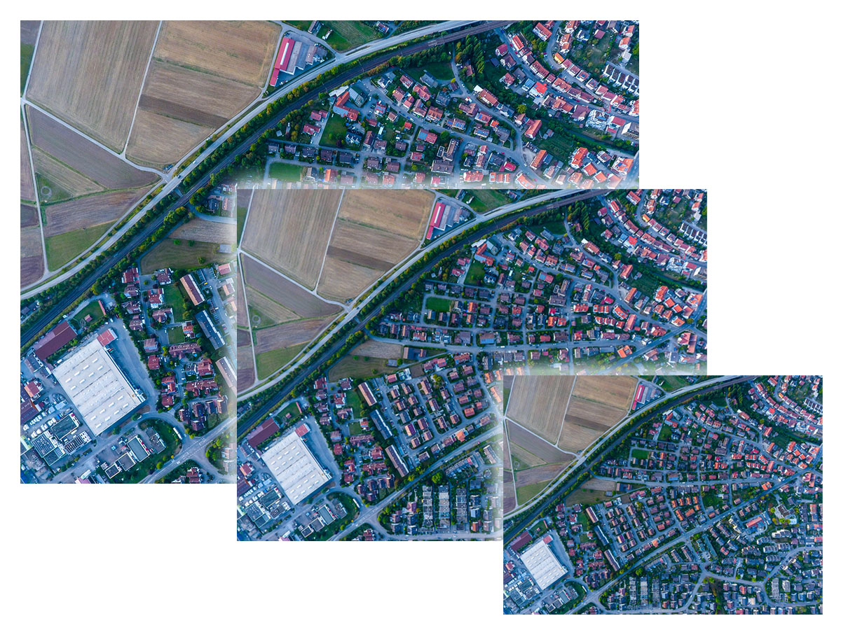
More and more high-definition satellite, aerial and drone imagery is being used throughout just about every industry.
And whilst that provides invaluable insights to people all around the world, the ever-increasing file sizes can make sharing, viewing, and manipulating this data extremely difficult and in some cases, expensive.
GeoExpress, originally created by LizardTech now owned and managed by Extensis, enables anyone to compress imagery to the industry-standard MrSID format.
The MrSID 'wavelet compression' file format supports lossless and visually lossless end-products, enabling users to shrink file sizes to their individual specifications, without sacrificing image quality.
GeoExpress is more than just compression. The software includes editing capabilities for such as cropping and color balancing, while also enabling users to reproject images and mosaic them together.
Reduce File Size, Maintain Image Quality
MrSID is able to halve the file size of images, with no loss of data.
This means that storage costs can be significantly reduced just by converting archive imagery to MrSID
If some data loss is acceptable, GeoExpress can compress images to 5% of their original size whilst the images remain visually lossless
Compressed images are easier to store, access, and share. Their small file size makes them accessible even on mobile devices and in low bandwidth environments.
Customize Your GIS Imagery
GeoExpress provides a comprehensive suite of editing tools that empower you to create the exact image you need.
Crop, color balance and reproject images.
Combine multiple images into seamless mosaic datasets.
Create MrSID files using your existing GIS imagery and data
Export only selected sections of imagery you want, at the exact size and resolution you need
Use alpha bands to add true transparency to your imagery.
Integrate Imagery Assets with a Variety of GIS Applications
Industry-standard MrSID format integrates seamlessly with other applications.
Process, classify, and interpret your imagery without program compatibility concerns. GeoExpress can be used in combination with nearly all geospatial applications, including ArcGIS, Global Mapper, QGIS, Autodesk, ERDAS, ENVI, SOCET GXP, and Microstation.